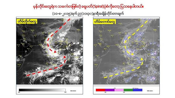
RANGOON — As Burma continues to reel from its worst floods in recent memory, signs of a low pressure system in the Bay of Bengal have brought fears of more rains to already inundated areas in the coming days.
Meteorologist Tun Lwin wrote on his Facebook page on Wednesday that a low pressure system identified in the Bay of Bengal to Burma’s southeast could develop into a low-grade storm, according to readings taken late on Tuesday night.
“If it happens, it could begin as a small storm but will not pass [directly] over Burma. It would pass over India as a small inland storm, move north-west and then dissipate.”
Burma’s Ministry of Information sent a text message to mobile phones on Monday warning of a tropical depression forming within 48 hours in the Bay of Bengal—a weather pattern confirmed through an announcement Wednesday by the Department of Meteorology in the state daily The Mirror.
According to Tun Lwin, Pegu, Rangoon, Pathein in Irrawaddy Division, Thaton in Mon State and Shwebo in Sagaing Division will likely face further rains and flooding in the coming days.
The Department of Meteorology stated there would be more rainfall over the next two days in northern Burma, while scattered rain is expected across Magwe Division, Irrawaddy Division and Chin State.
Over 1.1 million people in Burma have been severely affected by floods across 12 states and divisions, according to the UN Office for the Coordination of Humanitarian Affairs (OCHA)’s latest situation report issued on Wednesday. At least 103 people have died since June, UN OCHA said.


