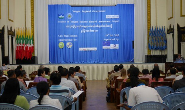
RANGOON — A one-year seismic hazard assessment will be conducted for Rangoon, Burma’s biggest city, which lies in a zone of the Earth prone to earthquakes.
At a ceremony to launch the project last week, Nicolas Louis, the director-general of the European Commission Humanitarian Aid and Civil Protection (ECHO Myanmar), said that the growing number of high-rises in Rangoon and the city’s burgeoning population in recent years necessitated the study.
The results will be used to mitigate what could be considerable losses if a major earthquake strikes the commercial capital, he added on Thursday at City Hall.
The Myanmar Geosciences Society will carry out the assessment with the assistance of the Myanmar Earthquake Committee and other concerned associations, with the authorization of the Yangon City Development Committee (YCDC). The project will begin later this year, with financing from the Myanmar Consortium for Community Resilience (MCCR), an affiliate of ECHO Myanmar and UN-Habitat.
Burma is divided into five zones related to potential earthquake intensity: The tiered categories define risk levels as low, moderate, strong, fierce or devastating. The commercial capital lies in an earthquake zone of moderate to strong intensity, according to local seismologists and geologists.
“We are studying the resiliency of the town in case of seismic waves,” said Soe Thura Tun, vice chairman of the Myanmar Earthquake Committee. “We are also studying the possible intensity of earthquakes in different parts of the town. We’ll combine the results and determine the risks and vulnerability of respective parts of the town.”
He underscored the need for an accurate seismic hazard assessment so that related regulations on quake resistance could be enforced on already built and future planned high-rise buildings.
Myo Thant, a lecturer from Rangoon University’s geology faculty and a member of the Myanmar Earthquake Committee, stressed that it was critically important that lawmakers put the results of the assessment to good use in order to facilitate sustainable urbanization.
“It will be useless if the report is just placed on the bookshelf. That report must be for bona fide use. It [the report] will take effect only when it gets into the hands of authorities at different levels. It will be of no use if it does not take effect,” he told The Irrawaddy.
It would be easier to educate Rangoon residents who live in earthquake-prone areas of the city after the seismic hazard assessment came out, he added.
UN-Habitat said that similar assessments were being carried out in the towns of Pegu, Sagaing and Toungoo.
Burma has seen at least 19 tremors that measured above 7 on the Richter scale, 7.0 being the same magnitude as the earthquake that devastated the Haitian capital Port-au-Prince in 2010.
Burma rests on a particularly active tectonic zone, with one of the world’s two main fault lines running through major Burmese cities including Mandalay, Pegu and Rangoon on its way from the Mediterranean to Indonesia.
Strong earthquakes rocked Tarlay in eastern Shan State in 2011 and Shwebo in Sagaing Division in 2012, with scores of casualties reported in both disasters.


