
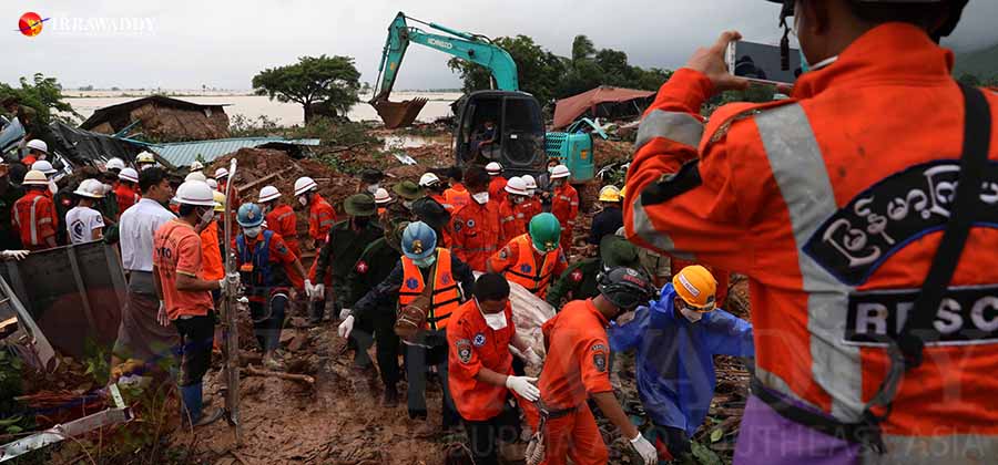
PAUNG TOWNSHIP, Southern Myanmar—Second Vice President Van Thio has instructed officials and geologists in southern Myanmar’s Mon State to immediately test land conditions in hill areas there, after landslides killed at least 57 and left dozens more missing in Mottama, in Paung Township, over the weekend.
The deadly landslide struck at the base of a mountain there early Friday morning; rescue workers have been recovering bodies all weekend.


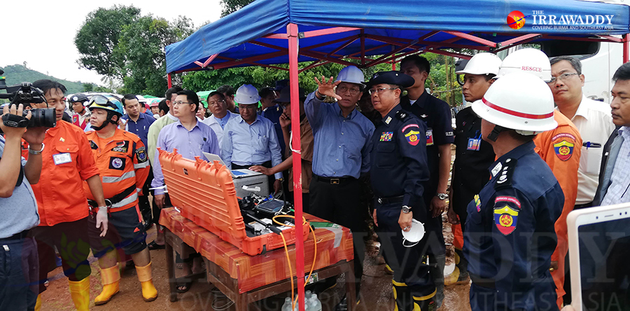
Van Thio visited the site and viewed aerial footage taken by drone cameras there Sunday afternoon, during a three-day visit across the affected region (from Saturday to Monday) with Minister of Social Welfare, Relief and Resettlement U Win Myat Aye.
U Win Myat Aye told The Irrawaddy on Monday that the flooding is the worst Mon State has seen in 30 years, adding that some residents escaped with only the clothes on their backs.
“We’re providing whatever support we can, and we will continue to do so as [the victims] try to rehabilitate,” he said.
“The Second Vice President said action will be taken as soon as experts have examined the area, marked potential future landslides and determined how best to prevent them,” said Mi Kun Chan, a Paung Township lower house lawmaker.
It is unclear whether funding for such initiatives will come from a Mon State fund reserved for disaster spending or from the Union government. Mon State is currently spending from its 500-million-kyat disaster response fund to deal with the disaster.
At least seven separate landslides occurred throughout Paung Township this weekend after nearly a month of heavy monsoon rains. Locals blame landowners there that sold their land to mining interests, who then destroyed the soil and the hills there.
U Zaw Zaw Htoo, a Mon State lawmaker representing Paung Township, said at least four of the seven landslides were the direct result of the destruction of hills there by miners and the landowners that sold the land to them.
“If people want to dig on their own land, they can, but there has to be a safety system in place,” he said. “Mining is necessary for infrastructure development—for connecting villages via roads, for instance—but it needs to be planned and systematized so that things like deadly landslides don’t happen.”
“Land used for mining has to be far away from where people live, and the land must be tested for safety first,” he said.
If testing is now done quickly and the public warned promptly of further possible danger, U Zaw Zaw Htoo added, people can prepare to evacuate.
Rescue efforts were ongoing as of Monday.
Paung Township administrator U Zaw Moe Aung said rescue workers are still finding bodies using ground detectors.
As of Monday, more than 90,000 people from Karen and Mon states and Bago, Irrawaddy, Tannitharyi, Sagaing, Mandalay and Magwe regions have taken shelter at flood relief camps, according to Daw Lei Lei Aye, deputy director-general of the Ministry of Social Welfare, Relief and Resettlement’s Disaster Management Department.
After two months of flooding, Mon State has been the most severely affected, with over 39,000 people from 9,000 households in Bilin, Kyaikmayaw, Thaton, Thanbyuzayet, Ye, Mawlamyine and Paung townships sheltering in relief camps, she said.
Htet Naing Zaw and Nyein Nyein contributed to this report.
You may also like these stories:
52 Dead in Mon State Landslide; Southern Myanmar Still Flooding
Floods Displace Scores Across S. Myanmar
Nearly 9,500 People Affected by Rakhine State Floods


