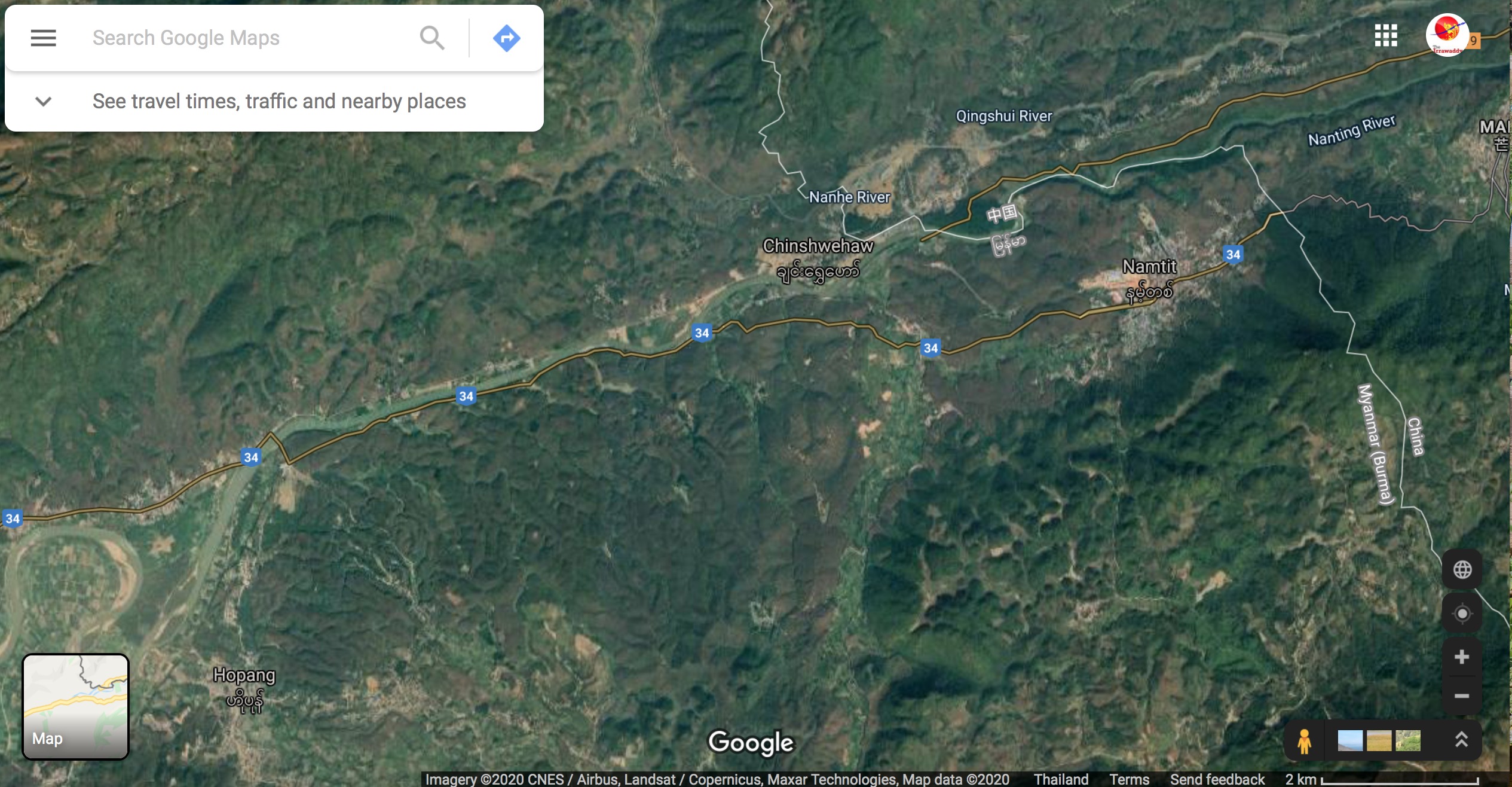
Myanmar officials visited the Chinese border in Hopang District of the Wa Self-Administered Zone in northern Shan State early this week to observe a boundary issue, as China is building retaining walls on two streams along the border near Namtit Town.
The Myanmar government is concerned that the Chinese retaining walls will cause soil erosion on Myanmar’s side of the streams, both tributaries of the Salween River.
Officials led by U Aung Kyaw Zan, director general of the Consular and Legal Affairs Department, visited the streams in the hope of finding a way to prevent the erosion, according to a statement issued Thursday by the Myanmar Ministry of Foreign Affairs (MOFA), which oversees the Consular Department.
According to MOFA, the Chinese authorities have placed large stones in the Nanting stream to expand the bank on their side of the waterway, and to build retaining walls, which are near Border Post No. 145(1). The Chinese have also reportedly built a road in the area. MOFA said the Chinese side has also built retaining walls on the Namt Kun stream and the Namit tributary stream near Border Post No. 158(1).
Both border posts are in Namtit Town in Wa Special Region 2, which is under the control of Myanmar’s largest ethnic armed group, the United Wa State Army/United Wa State Party.
U Thein Min Tun, director of the Boundary Division under the Consular and Legal Affairs Department, told The Irrawaddy on Friday that he and other officials visited the area from Saturday to Wednesday to see the issue in person.
“We went there to see the situation, what [the Chinese] are doing and whether it will erode more of our soil, as the boundary is along these waterways,” he said.
Myanmar and China share a border of over 2,200 km that includes both land boundaries and waterways in Myanmar’s north and northeast.
U Thein Min Tun would not give details as to what the Myanmar government will do to deal with the issue.

“We have already established mechanisms to deal with such disputes and we will use them,” he said, adding that border boundary disputes are not uncommon for countries that share borders.
“Many citizens are not aware of the border demarcation. As they don’t know, they build buildings or infrastructure on the boundary or crossing the boundary. This is common,” he said.
MOFA also said that the officials visited areas where, in previous years, Chinese border forces have destroyed the Myanmar flag.
“As we were in the area, we went to assess the situation,” said the Boundary Division director.
The officials also visited the Kokang Self-Administered Zone and discussed the border trade zone planned for the area as well as boundary demarcation.
Last September, the Myanmar government announced that it would work with China in 2020 to conduct their third joint inspection of the shared boundary.
The countries signed a boundary protocol in 1961, under which they agreed to conduct joint inspections of the demarcated boundary every five years, but this has so far only occurred twice—in 1984-86 and 1992-95.
A dispute over the border with China in northern Shan State has simmered since 2008. In September 2018, a row erupted over the location of the boundary between the two countries on the Ruili River near northern Shan State’s Muse Township.
The dispute erupted near Pang Sai Kyukote Sub-township in Muse when Chinese villagers put up a fence nearly 30 meters inside Myanmar, in Hpai Kawng Village. The Chinese villagers eventually took down their fencing materials after Myanmar villagers complained to district officers.
You may also like these stories:
Myanmar Military Helicopter Crashes Carrying Foreign Military Attachés: No Deaths
Lawsuit Against Yangon Water Bus to Move Ahead, Fuel Bills Still Unpaid


