
4: Two State Capitals
Karsts and caves: Hpa-an


Few buildings in Hpa-an, the capital of Karen State, are higher than its clock tower. Volleyball games enliven a promenade along the Salween River (formerly known as the Thanlwin) in the afternoon, and a night market by a small lake is within walking distance of the town center. Good hotels and restaurants help its reputation, but the surrounds are what make the town a tourist destination.
To the east, the lights from pagodas mark the summits of karsts as if they were stars in the night sky. The closest viewpoint, however, is a ferry ride across the river to the west bank and a hike up to the Pha Bu Taung Pagoda.
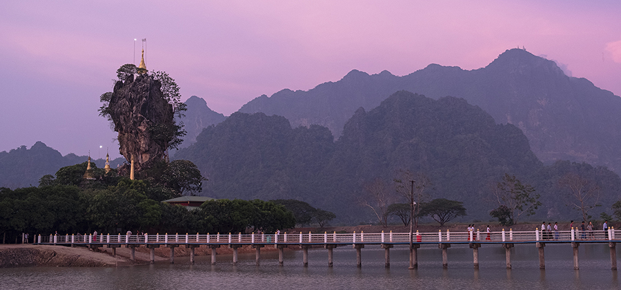
Hpa-an’s signature sights are a short drive south. The first is the unusual Kyautt Ka Latt Pagoda set on a small karst amid a lake. To the east, Mount Zwegabin towers higher than 700 meters. A trail of more than 3,000 steps ascends the east side of the ridge up to the pagoda on its summit. A second, less abrupt trail begins on the west side near the Lumbini Buddha Garden.
It is best to start a climb up Zwegabin as early as you can. The sweaty climb took me longer than two hours; a Buddhist nun nimbly overtook me on the way up, her pink and white robes no impediment to agility.
Sunlight cast harsh shadows at the top; views were hazy when not shrouded in cloud. In the cold season, they would be superb, especially at dawn or sunset.
Located some 20 kilometers to the south, where the ridge abruptly drops down and ends in a flat alluvial plain, the Mahar Sadan Cave (as Google calls it) is physically the most impressive of the caves near Hpa-an.
Visitors make offerings to Buddha images at the cave’s southern entrance and can then walk for around 200 meters through the cave. The trail is sometimes muddy and the unwary can stub their toes against rocks in dimly lit areas.
The trail emerges in a dell bound by karsts and a creek that disappears beneath an overhang. A second entrance leads to an equally long walk-through cave. Perhaps I missed the donation box, for the lights went out halfway.
Visitors can return by boat on the creek. It flows through a cavern, emerges into a wetland and follows a channel to a disembarkation point. It was a short, stony trail back to where I had mistakenly left my shoes instead of carrying them.
From the cave, short, easy drives go back to Hpa-an or on to Mawlamyine in Mon State. On the road to Mawlamyine, the Kha Yone Cave is another longish cavern with some Buddha images. Statues of monks holding alms bowls line a side road to the monastery nearby, where the walls of a short cave are tightly packed with yet more Buddha images.
On the waterfront: Mawlamyine
Mawlamyine is a treat. The city is not so busy or large that it is a challenge to navigate. Visitors had best start on Strand Road along the waterfront of the Salween Estuary. Hotels, restaurants and a night market are not so far from each other as to discourage walking between them in the evening.
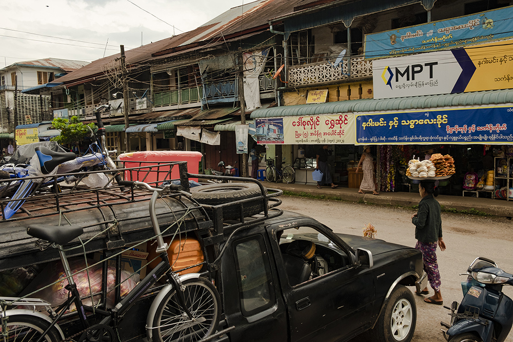
Islam spread from its Middle Eastern roots along trading routes, so it is along Lower Main Road inland from Strand Road that the city’s two large mosques and main Zwei Gwi market are located. Trucks clog the streets near the market in the morning.
The pace of business in the market slows in the afternoon. A few food stalls and brightly lit mobile phone shops enliven Lower Main Road after dark; in the evening, commerce migrates to other parts of the city.
On Strand Road, meanwhile, folks amble along the promenade or loll against its parapet, chatting while gazing over a muddy foreshore and reflections of a darkening sky silhouetting Bilu Island (Bilugyun).
As if washed up by a tide of human migration inland from the commercial zone near the waterfront, churches and colonial-era buildings stand on higher ground nearer the foot of the north-south ridge that dominates the city. The ridge separates the old city and waterfront to the west from Highway 8, the railway and newer suburbs to the east.
The old city was where the British built up “Moulmein” as the administrative center of their colony on peninsular Burma. Formerly a part of the Burmese Empire that extended from Assam to Siam, the territory south of the Thanlwin River (together with Assam) was ceded to the British by Ava in the punitive Treaty of Yandabo at the end of the First Anglo-Burmese War in 1826.
Built in 1928, the City Hall still serves its function, but guards may discourage visitors wishing to photo the city clock tower located in its forecourt. Only a dark interior hinders photography in the Mon Cultural Museum nearby, where the 5,000-kyat (US$3.50) entrance fee includes the loan of a torch to illumine exhibits.
Cultural museums in Myanmar are usually worthwhile, for there is always something that sheds light on the locality.
As befits higher aspirations in Buddhist philosophy, pagodas dominate the skyline along the ridge. In a large hall near the northern end of the ridge, the Mahar Myatmuni Buddha image sits resplendent amid a glittering backdrop of glass mosaic.
Nearby, a lift takes pilgrims up to the Kyeik Tha Lan Pagoda and a viewpoint east and west. A road runs south along the ridge, passing other pagodas and viewpoints. These are good places to watch a setting sun burnish golden phayas and imbue the estuary with the myriad hues of day’s end.
Oliver Hargreave created “WorldClass Drives in Myanmar” for Yomacarshare.com. The opinions expressed in this article are not those of Yomacarshare.
You may also like these stories:
Shelling Fractures Families in Myanmar’s Conflict-Torn Shan State


